Aller au contenu principal
Blog
Accessibilité
Voir les favoris
en
Rodez Agglomeration Tourist Office
Be inspired
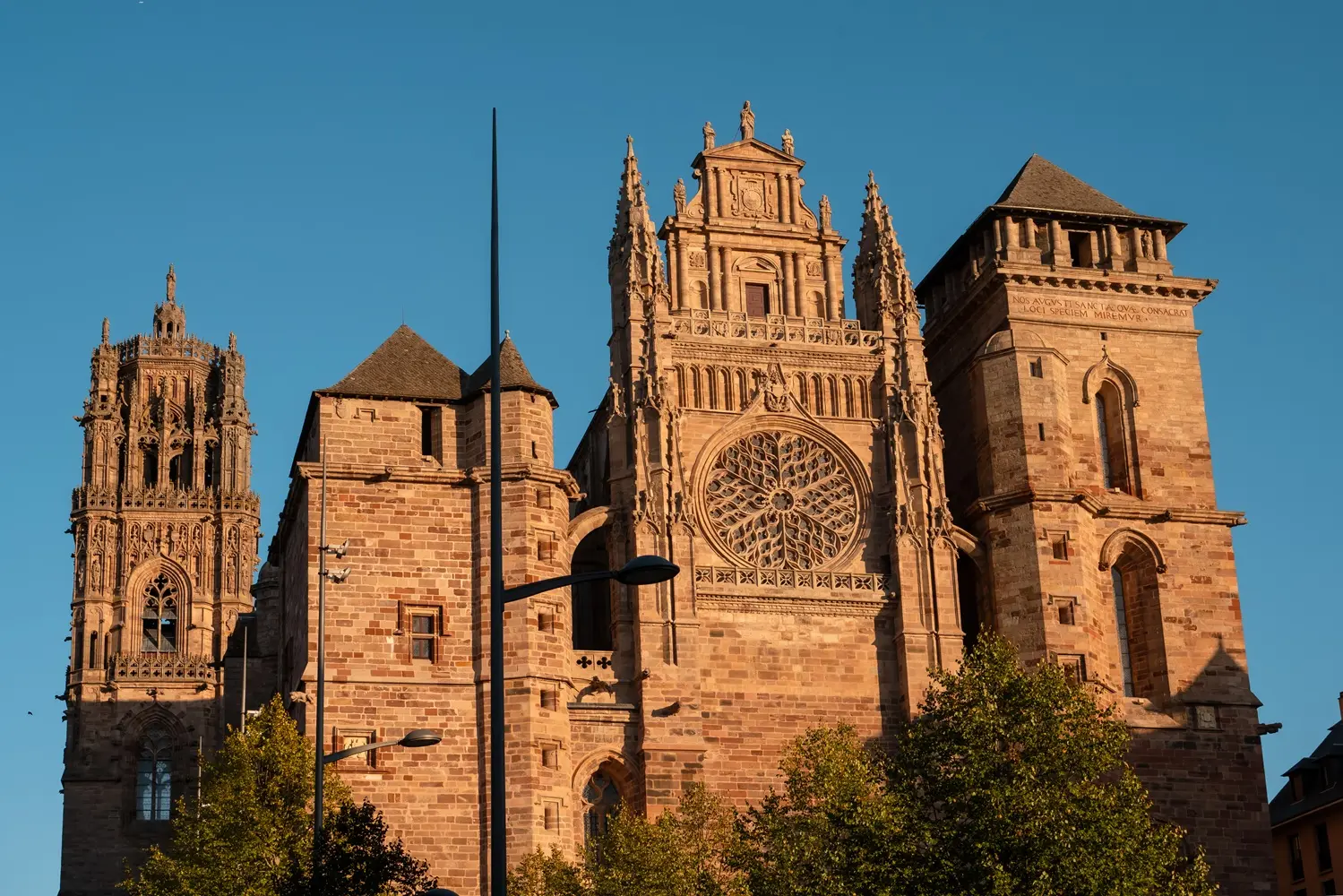
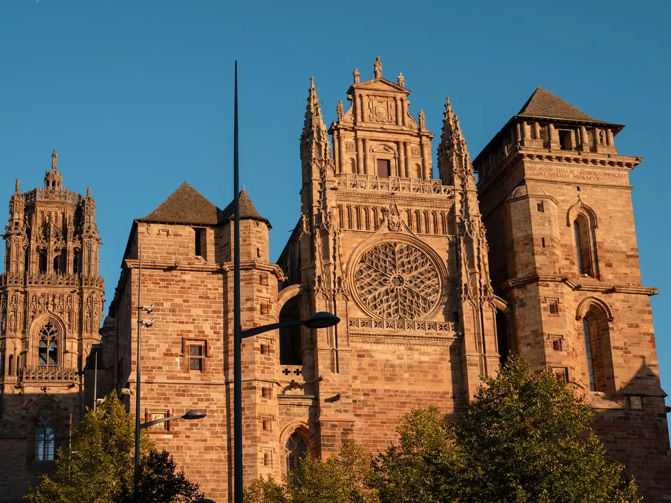
Listen to the tale of Rodez cathedral and old town
Les statues-menhirs du musée Fenaille
©
Les statues-menhirs du musée Fenaille
Meet a great dame at the Fenaille Museum
Outrenoir dans une salle du musée Soulages à Rodez
©
Outrenoir dans une salle du musée Soulages à Rodez
Soak up the Soulages light
Sculptures du musée Denys-Puech
©
Sculptures du musée Denys-Puech
Sculpt your curiosity at the Denys-Puech Museum
10 Other good reasons to come to Rodez
Plan your stay
Top Activities
Where to get some fresh air?
What to do with the family ?
Immerse yourself in the gastronomy
Hôtel Mercure
©
Hôtel Mercure
Accomodations
Salle de restaurant du Café Bras
©
Salle de restaurant du Café Bras
Restaurants
Carte touristique de l'Aveyron
©
Carte touristique de l'Aveyron
Coming to Rodez and getting around
Tyroliennes face à la cathédrale de Rodez
©
Tyroliennes face à la cathédrale de Rodez
Things to do
La Petite Créatrice - Rodez
©
La Petite Créatrice à Rodez
Shopping in Rodez
Close at heart and hand
Around Rodez
Druelle Balsac
Le Monastère
Luc-la-Primaube
Olemps
Onet-le-Château
Sainte-Radegonde
Sébazac-Concourès
Najac en famille
©
Najac en famille
the most beautiful villages of France in Aveyron
Abbaye Cistercienne du village de Conques
©
Abbaye Cistercienne du village de Conques
From Rodez to the Occitania South of France Grands Sites
What's on ?
Welcome to Rodez !
01- Rodez Centre-ville
01- Rodez Centre-ville
Walking/pedestrian
12000 Rodez
Getting there
×
Open the itinerary in
Google Maps
Apple Plans
Waze
Mappy
I'm going by train!
×
Please note that the nearest station is more than
Share
Ajouter aux favoris
Add to my favorites
×
Share this sheet
01- Rodez Centre-ville
E-mail
WhatsApp
Facebook
X
LinkedIn
Pinterest
Documentation
FICHE 1 - RODEZ_HD.pdf
Close
Popular searches
{% label %}
Page suggestions
Vue du musée Soulages et cathédrale à Rodez
©
Vue du musée Soulages et cathédrale à Rodez
|
P.THEBAULT - CRT Occitanie
Be inspired
Filter search
Page types
All
Articles
Agenda
Lists
Aucun résultat
/
English
Français
Español
Close
×